GA 8944 – Miles Fashion
- Estimated Delivery : Up to 4 business days
- Free Shipping & Returns : On all orders over $200
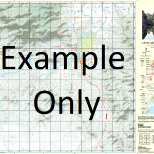
This Topographic Map is produced by Geoscience Australia; Australia s national geospatial organisation.
GA topographic maps (many of which are produced in partnership with the Army) are generally older than those maps produced by the State Governments over the same area. This makes GA maps particularly useful for identifying historic features, such as old mines and diggings.
Geoscience Australia maps generally considered to be more pleasing in design and compilation then the more modern State Government productions.
At this scale, 1cm on this map represents 1km on the ground. A standard map (which is square) covers an area of approximately 54km by 54km, with a contour interval of 20m. This map contains natural and constructed features including road and rail infrastructure, vegetation, hydrography, contours, localities and some administrative boundaries.
Please note the date of the map, as this will impact the currency of information, particularly regarding infrastructure, roads, etc.
Lauroy Hookswood Castledean Boortkoi Linton Skipton Wallan Dale Oakville Glengyle Glen Eric Kentucky Mayberry Wilga Park Lawn Hill Fairview View Hill Glenross Wallan Park Hollymount Retreat Kia-Ora Cameby Downs Golden Valley Wahroonga Woollahra Wallan View Glenroy Golden Gates Bridgen Pleasant Hill Hurlstone Yarrandale Blue Hills Ayton Sunny View Glenison Aldersyde Homefields Oxford Downs Avon Downs Glenbar Slamat Bonnie Doone Winniston Drillham Bulrush Wellwood Tarella Fermoy Iola Yuwandi Forest Glen Wongalee Ardnaree Orient Thornton Gleneden Wandaloo Lorraine Arwallon Rugavale Lone Pine Kotupna Park Yellowstone Killawarra Waterloo Tregarthyn Riverside Limebush Rowena Grantham Park Gilmore Tharlawe Berwyndale Kooralbyn Condabri Tinobah Cullingral Thornelde Bimbian Plains Coonamallee Rayford Park Monreach Wambo Downs Yandarloo Paradise Downs Warranee Argyle Royalty Kentara Glen Olive Nangram Windibri Fairymeadow Redbank Helenvale Wieambilla Wambo Sunny Glen Camilaroi Dundee Wongalea Coolamala Wilga Downs Orana Beaufort Park Blackdown Bindibi Rainbow Bend Merlan Redmarley Coolibah Kanimbla Ellerslea Boothvale Kalawa Cobbareena Kilrush Kenya Miles Akers Gully Arubial Arubial Lagoon Bartsch Binbian Blackswamp Creek Bogrambilla Creek Bottle Tree Creek Boyanda Bulwer Caliguel Lagoons Cameby Cameby Creek Camisla Creek Cobbareena Creek Columboola Columboola Creek Condamine Cooloomala Creek Cooloomala Creek North Branch Cooloomala Creek South Branch Dalwogan Dogwood Doutt Gully Drillham Creek Eleven Mile Creek Four Mile Creek Goombi Goonalah Graveyard Creek Horseshoe Lagoon Jack Creek Jump Up Creek Lambing Creek Mackie McNulty Mooma Lagoon Nangram Lagoon Nine Mile Creek One Mile Creek Paddy Creek Picurda Punch-Bowl Creek Quinn Gully Rainbow Creek Rainby Creek Rocky Creek Rywung Sandy Creek Sandy Gully Seventeen Mile Creek Sheepskin Gully Six Mile Gully Stockwhip Creek Tiereyboo Tomahan Creek Turkey Gully Wallan Wallan Creek Wambo Creek Wieambilla Creek Wilkins Creek Yamo Kowguran Myall Park Wieambilla Murilla Shire Crossroads Greenswamp Dalwogon Black Swamp Creek Colamba Creek Punchbowl Creek Bottletree Creek Miles Hill Paddys Creek Mannhurst Westcourt Quin Gully Glencarth Sunnyglen
| Title | Paper, Laminated |
|---|
Related products
-
QLD 6546 Discount
$12.50 -
QLD 6560 For Cheap
$12.50 -
QLD 6559 Discount
$12.50 -
QLD 6551 Supply
$12.50