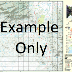
GA 8932-3 – Olinda Cheap
- Estimated Delivery : Up to 4 business days
- Free Shipping & Returns : On all orders over $200
This Topographic Map is produced by Geoscience Australia; Australia s national geospatial organisation.
GA topographic maps (many of which are produced in partnership with the Army) are generally older than those maps produced by the State Governments over the same area. This makes GA maps particularly useful for identifying historic features, such as old mines and diggings.
Geoscience Australia maps generally considered to be more pleasing in design and compilation then the more modern State Government productions.
At this scale, 2cm on this map represents 1km on the ground. A standard map (which is square) covers an area of approximately about 25km by 25km, with a contour interval of 10m. This map contains natural and constructed features including road and rail infrastructure, vegetation, hydrography, contours, localities and some administrative boundaries.
Please note the date of the map, as this will impact the currency of information, particularly regarding infrastructure, roads, etc.
Crow The Winton Lugan Park Little Springs Bellara Cotswood Akuna Parkthe Mount Brace Rawdon Willow Glen Kona Hidden Valley Ranch Dabee Glen-Lee Fernside Spring Gully Rambles Mollethe Hillside Kildare Roselea Falcon Olinda Eastwood Rockdale Ti-Tree Tebradden Mycumbene Hillview Burrowoury Marloo Marsden Kendun Norths Dunville Weemala Bogee Glenelg Tambo Glenbrook Marlyn Noola Brymair Marsden Forest Kooringle Mystic Glen Wongalee West Lodge The Nile Nilethe Norbiton The Pines Fairview Melrose Oakwood Valley Apiary Tayar Glenolan Laidley Warrangee Park Glencoe Bare Hills Basin Creek Beer Bung Creek The Big Hole Bogee Angle Bogee Nile Creek Bourbin Creek Brymair Creek Camp Flat Capertee Capertee Nile Creek Chimney Stack Clandulla Mount Conourury Coolcalwin Mount Coolcalwin Cornelia Coxs Creek Currant Creek Dairy Creek Davis Swamp Deep Creek Durambang Creek Mount Durambang Mount Gangang Ganguddy Ganguddy Creek Geologist Ridge Goongal Hanging Rock Harris Gap Hopping Harrys Hollow Horse Gap Kandos State Forest Kandos Weir Currant Mountain Swamp Dairy Swamp Davis Creek Dunns Mountain Swamp The Green Hills Grose Public School Kandoo State Forest Kindalwry Kings Swamp Long Cave The Long Cave Long Hollow Long Hollow Creek Mount Marsden Moose Hill Moose Mountain Never Never Never Never Creek Numietta Creek Rams Head Mountain The Rams Head Ram Station Creek Rylstone Rylstone Dam Rylstone Kandos Cemetery Sampsons Creek Sawpit Creek Sheridan Hill Spring Creek Spring Gap Spring Gully Creek The Stack Range Stack Ridge Stallion Gully Star Gully Star Valley The Swamp Swampy Creek Swampy Flat Tailbys Gap Tawinbang Tayar Creek Tayar Gully Teatree Creek Teatree Flat Teatree Gully The Left Hand Corner The Running Water Thistle Flat Creek Tongongwel Touwouwan Mount Touwouwan Towinhingy Creek Mount Towinhingy Umbiella Umbiella Creek Warrengee Creek Windmill Creek Windmill Hill Bull Frog Creek Bull Frog Gully Thistle Flat Cumber Melon Mountain Tayan Peak Tayan Pic Dunville Loop Federation Square Dunns Swamp Rumkers Peak Tongongwei
| Title | Paper, Laminated |
|---|

