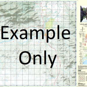
GA 8535 – Gulargambone Online Sale
- Estimated Delivery : Up to 4 business days
- Free Shipping & Returns : On all orders over $200
This Topographic Map is produced by Geoscience Australia; Australia s national geospatial organisation.
GA topographic maps (many of which are produced in partnership with the Army) are generally older than those maps produced by the State Governments over the same area. This makes GA maps particularly useful for identifying historic features, such as old mines and diggings.
Geoscience Australia maps generally considered to be more pleasing in design and compilation then the more modern State Government productions.
At this scale, 1cm on this map represents 1km on the ground. A standard map (which is square) covers an area of approximately 54km by 54km, with a contour interval of 20m. This map contains natural and constructed features including road and rail infrastructure, vegetation, hydrography, contours, localities and some administrative boundaries.
Please note the date of the map, as this will impact the currency of information, particularly regarding infrastructure, roads, etc.
Sandhurst Luckenough Telarah Moonya Warrana Murrayfield Modell Thooloomi Fairfield Walla Valley Vale Woodlands Riverside Lona Kirkcauldie Eulalia Gilgi Wongoola Caloola Park Leeholme Tooloon Tooloon South Geanmoney Glendale Omeo Grassmere Talegar Old Emby Orwell Yarrawood Alawa Rosedale Argilla Kingsdale Kuringai Morningside Wairoa Emby Gundegulah Kialgora Oakland Neinby Glenlea Strathvon Neeworra Girrahween Glenrowan Delamere Mafekin Bombangaran Augathella Belmont Goorangarby Wild Wood Weetah Yungenbah Budgeon Wingenbah Athlone Sandgate Granueale Caboonya Tultabah Lanauria Cloonabrika Braeburn Lewinsfield Ulundry Brightling Bundabulla Cre-Crin Wavertree Yarramundi Pretoria Uangra Kerribee Eureka Kindamindi Inglewood Pine Grove Newhaven Ellerslie Merri Merri Glencoe Warrawee Santa Paula West Point Warrambone Bourbah Belara Warrie Eirraw Troon Murrimbong Merryvale Inglewarra Blamford Downs Dalwood Hughenden Avoca Warrie Downs Wilbermere Widgeree North Woodside Boree Brinawa Burwood Paistex Youldoo Verona Weronga Nepean New Gular Mellerstain Woodside Calga Park Terang Densley Broadwater Wyrona The Maze Kinross Dunromin Earlside Morotai Pine Clump Brewarra Wallaroy Homebush Cordale Cheeridel Webegong Back Merrigal Back Tenandra North Bullagreen North Armatree Wonga Wangaratta Glenwood Masterton Yarran Macville Glenmuir Kooringle Saratoga Glenmore Grandoon Park Wilga Plain Bellvue Chosan Jindalee Emu Park Millawa Eumerella Old Bundilla Merridgerri Dragon Weona Park Koorawatha Tarrawonga Erdec Bullagreen Gulargambone Back Creek Amareb Creek Amareb Gully Village of Armatree Armatree Beladgerie Dam Boebung Bonbangrin Swamp Bonhangrin Swamp Bourbah Bore Bourbah State Forest Bullagreen Swamp Bullagreen Tank Cambara Carrabear State Forest Combara Combara Tank Connibong Dead Gum Lake Eulah Gandymungydel Gibber Waterhole Gilguldry Gilguldry Waterhole Gular Gulargambone Bore Gulargambone Cemetery Gulargambone Central School Healy Illurmurgalla Waterholes Galargambone Galargambone Creek Gular Rail Kialgara Bore Little Merri Merri Creek Long Waterholes Merri Merri State Forest Merrigal The Monkey Scrub Moolambong Nedgera Bore Nedgera Swamp Pine Gully Quonmoona Sandgate State Forest Tailby Tailby State Forest Tallegar Tallegar State Forest Tameribundy The Quiet Corner Walla Walla Plain Wamabung Dam Warrana Tank Warrie State Forest Wemabung Dam Wingebar Dooroombah Dragon Cowal Droggy Lake Bundilla Armatree Bore Black Swamp Brightling Railway Station Combara Railway Station Gular Bore Gulargambone Memorial Park Gulargambone Sportsground Merri Merri Swamp Sandgate Flora Reserve Jack White Memorial Park Jean Walker Park Embie Bonbangram Swamp Village of Gular Bill Delaney Park Euramie Worringerong Creek Worinjerong Creek Warranah Oaky Creek Mitchell Creek Kialgara Upper Neinby Girahween Baronne Creek Wilber Creek Tooraweenah Creek Mariemon Creek Tooraweenah Tank Mount Terrabile
| Title | Paper, Laminated |
|---|

