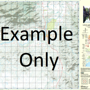
GA 8433 – Dandaloo Online
- Estimated Delivery : Up to 4 business days
- Free Shipping & Returns : On all orders over $200
This Topographic Map is produced by Geoscience Australia; Australia s national geospatial organisation.
GA topographic maps (many of which are produced in partnership with the Army) are generally older than those maps produced by the State Governments over the same area. This makes GA maps particularly useful for identifying historic features, such as old mines and diggings.
Geoscience Australia maps generally considered to be more pleasing in design and compilation then the more modern State Government productions.
At this scale, 1cm on this map represents 1km on the ground. A standard map (which is square) covers an area of approximately 54km by 54km, with a contour interval of 20m. This map contains natural and constructed features including road and rail infrastructure, vegetation, hydrography, contours, localities and some administrative boundaries.
Please note the date of the map, as this will impact the currency of information, particularly regarding infrastructure, roads, etc.
Beulah Widgeree Thornton Mulyan Braeburn Meringo Enmore Glenair Termoin Strathmore Goonimbah Auburn Galltee More Tabratong Rosewood Linbah Kilmarnock Galwarri Netherby Tyrie Newhaven Dungallon Inverlea Bywannah Eudundah Derribong Alagala Waterloo Wallanbillan Draggy Wendouree Trangie Annandale Tank Algalah Albert Tank Village of Albert Albert Back or Genaren Creek Barton Bentinck Cobacho Dam Corses Cowal Curtis Dandaloo Dandaloo Cemetery Dawes Crossing Deribong Derribong Crossing Deribong Tank Enerweena Farrendale Farrendale Tank Genaren Creek Goan Waterhole Graddle Hastings Hunts Tank Keefs Billy Creek Cobacho Tank and Dam Dandaloo General Cemetery Village of Dandaloo Ferrendale Tank Genaren or Back Creek Goan Myall Craddle Creek Meringo Cowal Middlefield Mungery Mungery Racecourse Murrumbah Nine Mile Cowal Ogles Camp Ormonde Ossory P.P. Tank Quartpot Lagoon Round Cowal Round Cowal Plain Sandy Creek Scott Park Sixteen Mile Tank Solomons Temple Swan Cowal Temoin Terowie Terowie Public School Trangie Village Of Trangie Cemtery Trangie Central School Trangie General Cemetery Trangie Park Trangie Post Office Trangie Railway Station Trangie Showground Trangie Showground and Racecourse Turribung Wellwood Willanbalang Yarradigerie Yralla Bullock Creek Bullock Tank Swamp Doonside Back or Genarin Creek Middlefield Station Derribong Dam Trangie Reservoir Darktown Quart Pot Lagoon Quondong The Boggy Cowal Meringa West Harnham Carrigan Cobacho Tank Derribong Tank Nardoo Kolonga Back Creek Bradys Cowal Ormond
| Title | Paper, Laminated |
|---|

