GA 8329 – Barmedman Fashion
- Estimated Delivery : Up to 4 business days
- Free Shipping & Returns : On all orders over $200
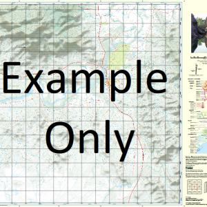
This Topographic Map is produced by Geoscience Australia; Australia s national geospatial organisation.
GA topographic maps (many of which are produced in partnership with the Army) are generally older than those maps produced by the State Governments over the same area. This makes GA maps particularly useful for identifying historic features, such as old mines and diggings.
Geoscience Australia maps generally considered to be more pleasing in design and compilation then the more modern State Government productions.
At this scale, 1cm on this map represents 1km on the ground. A standard map (which is square) covers an area of approximately 54km by 54km, with a contour interval of 20m. This map contains natural and constructed features including road and rail infrastructure, vegetation, hydrography, contours, localities and some administrative boundaries.
Please note the date of the map, as this will impact the currency of information, particularly regarding infrastructure, roads, etc.
Murribee Glendee Pinehurst Araluen Hill Brow Cypress Park Aorangi Killarney Cooinoo The Levels Rockdale Ilkeston Ipiriki Allambie Bull Plain Trigger Hill Roseleigh Kooringal Karoora Oakburn Fairview Koonda Oakleigh Rosevale Glenmore Bayoud Dundoo Illinois Glenview Wattle Park Dallinga Glencoe Park Pine Bank Bellevue Frontignac Ellon Vale Kaloola Iowah Oaklands Avenall Golden Hills Golan Vale Kildary Glenora Pine Valley Yurunga Maylen Vale Habbies Howe Devon Park The Ranch Woodlyn Kelso Park Cameo Rivington Stoneleigh Okabella Culingerai Balgay Hopevale Erinvale Kurrawang Vida Woodlands Hillview Merrimu Kal Kal Sherwood Stratholm Taradale The Pines Lilydale Wanganui Glenbower Pine Grove Hazelwood Ellerslie Stanwell Park Ros-Dale Tracton Pucawan Flowerdale Tallandoon Evandale Hazel Dean Carama Derona Kurrajong Hills West Hall Beaconsfield Scrubville Oki Oki Billaberry Kelroan One Tree Forest Dale Evelyn Pine Park Falmara Kingarra Fulton Grange Kooringa Walkaway Afton Glen Ira Wave Hill Glenwarren Avonlea Barmedman Ariah Park Back Creek Ariah Ariah Park Central School Ariah Park Post Office Ariah Park Railway Station Alleena Barmedman Creek Barmedman Public School Barmedman Railway Station Mount Beckham Beckham Belar Swamp Belimebung Bellarwi Bellarwi Railway Station Birren Birrenbed Boonabah Broken Dam Buddigower Buddigower Fauna Reserve Buddigower Nature Reserve Buddigower Railway Station Buddigower State Forest Buggajool Buggajool Range Buggajool Ridge Buggajool State Forest Bull Beds Cartwrights Spring Curragh Davidson Dunkirk Tank Ellon Gidginbung Gidginbung Railway Station Gidginbung Tank Greens Creek Gum Swamp Ingalba Nature Reserve Flagstaff Gully Langi Langi-Kal-Kal Mail Stables Tank Mandamah Mandamah Creek Mandamah State Forest Marbunga Mirrool Mirrool Creek Mirrool Public School Mirrool Railway Station Moonoon Tank Mustering Dam Tank Mustering Tank Native Dog Creek Nobbys Nobbys Lagoon Northcote Northcote Tank Oaky Hill Pucawan Railway Station Quandary Quandary Railway Station Quandary Tank Reefton Reefton Railway Station Reefton State Forest Village of Reefton Sandersons Tank Sandy Creek Sandy Watercourse Scotts Creek Skellys Tank Small Flat Creek Stony Hill Swanston Tara Temora State Forest Thanowring Therarbung Therarbung State Forest Thurungly Trungley Tank Victors Hill Village of Ariah Park Waarbilla Waarbilla Creek Walleroobie Wargin Wargin Railway Station Village of West Reefton Windeyer Wyalong South Yarran Yarranjerry State Forest Yarranjerry National Forest Yiddah Yiddah Railway Station Duckhole Bungambil Fishers Lagoon Five Mile Dam Harmans Tank Sproules Lagoon Primrose Tank Kildary Road Kildary Creek Sproules Lagoon Station Mount Beckam Dunwell
| Title | Paper, Laminated |
|---|
Related products
-
QLD 6559 Discount
$12.50 -
QLD 6560 For Cheap
$12.50 -
QLD 6554 Discount
$12.50 -
QLD 6648 Online Sale
$12.50 -
QLD 6551 Supply
$12.50