GA 8232 – Gindoono Sale
- Estimated Delivery : Up to 4 business days
- Free Shipping & Returns : On all orders over $200
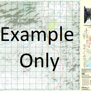
This Topographic Map is produced by Geoscience Australia; Australia s national geospatial organisation.
GA topographic maps (many of which are produced in partnership with the Army) are generally older than those maps produced by the State Governments over the same area. This makes GA maps particularly useful for identifying historic features, such as old mines and diggings.
Geoscience Australia maps generally considered to be more pleasing in design and compilation then the more modern State Government productions.
At this scale, 1cm on this map represents 1km on the ground. A standard map (which is square) covers an area of approximately 54km by 54km, with a contour interval of 20m. This map contains natural and constructed features including road and rail infrastructure, vegetation, hydrography, contours, localities and some administrative boundaries.
Please note the date of the map, as this will impact the currency of information, particularly regarding infrastructure, roads, etc.
Glenkerry Maroonbah Marranoonbah Majura Mumble Creek Vermont Hill Rosedale Springfield Fountain Dale Gundamere Wirrinun The Oaks Gonawyle Colindale Melrose Pinnacle Moonaculla Kereing Hill Eulendool Arundel Carinya Palistan Booloor Flamingo Tullinga Dunlop Roma Gilgais Wheataker Kooranjie Mayfield Rosevale Bimbella West Derrida Kinglieth Bimbella Scrublands New South Wales Boggy Creek Broken Range State Forest Vermont Hill State Forest Woggoon Nature Reserve Tollingo Nature Reserve Black Range Tank Mckenzies Tank Browns Tank Mombil Tank Bobadah Tank Connellys Dam Coobaguthrie Tank Boona Tank Kalinga Morrow Rawsthorne Beauport Marobee East Tallebung Urambie East Warrabillong Scollys Tank Oxley South Tinda Gindoono Willama Mamre Julandery Tollingo Greenock Mount Nobby Palisthan Mount Nobby State Forest Barratta Tank Stoney Hill Mombill Tank Gleninga Teran Creek Mineral Hill Mount Susannah Tinda Mountain Mount Tinda Lake Nicholls Kering Hill Tinda Creek Woolshed Hill The Three Peaks Dry Creek Mount Tallebong Mount Tallebung Palisthon Willuna Tank Crowie Creek Morumbil Swamp
| Title | Paper, Laminated |
|---|
Related products
-
QLD 6553 For Discount
$12.50 -
QLD 6558 Fashion
$12.50 -
QLD 6563 For Cheap
$12.50 -
QLD 6550 Supply
$12.50 -
QLD 6560 For Cheap
$12.50