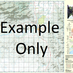
GA 8229 – Ardlethan Fashion
- Estimated Delivery : Up to 4 business days
- Free Shipping & Returns : On all orders over $200
This Topographic Map is produced by Geoscience Australia; Australia s national geospatial organisation.
GA topographic maps (many of which are produced in partnership with the Army) are generally older than those maps produced by the State Governments over the same area. This makes GA maps particularly useful for identifying historic features, such as old mines and diggings.
Geoscience Australia maps generally considered to be more pleasing in design and compilation then the more modern State Government productions.
At this scale, 1cm on this map represents 1km on the ground. A standard map (which is square) covers an area of approximately 54km by 54km, with a contour interval of 20m. This map contains natural and constructed features including road and rail infrastructure, vegetation, hydrography, contours, localities and some administrative boundaries.
Please note the date of the map, as this will impact the currency of information, particularly regarding infrastructure, roads, etc.
Bayfield Kolkilbertoo Blair Athol Ashburnham Tralee Woodlands Lenore Carawatta Coo-Ee Moorabinga Clearview Fairview Fair View Sunnyside Indarra Euronga Marungi Yarrangrove Box Grove Violetta Glendale Carinya Merridong Kia-Ora Kinross Avondale Wahroonga Heather-Brae Murillo Waranga Yarrandale Bobadil Pleasant View Yarran Myee Wongabeena Tarellan Hillview Glen Elgin Pine Hill Lone Pine Cairn Mount Blue Dam Sandy Creek Wilga Vale Saddle Back Kelling Belah Glenhope Norwood Park Greenwood Park Cotswold Stoneycroft Daisydale Marathon Glenlea Merthyr The Junction Araluen Warrinah Fairfield Nestorville Goldenhope Mount Jillett Goyura Emohruo Islay Lyndale Genista Millfarm Glenburnie East Yalgogrin Udale Iona The Ranch Wallerawang Minilyn Sunnybrook Glenisla Melvyn Bimbi Evening-Side Pinevale Ellon Vale Warrack Park Cranbrook Dumossa The Homestead Mortlock Farm Coondarra Gaddong Rosevale Somerset Grange Glen Iris Taradale Pine Vale Tydfil Ivanhoe Nanveena Cashmere Mallee-Vale Valley View Corriedella Rodmell Pine View Glen Pine Hamel Bolero Quambi Glengarry Berrima Pineview Allambee Park Langley Park Braeside Blue Mount Golden Hills Melrose Brolga Inveress Oakover Strathaven Berrimal Wangrabelle Weerina Maxwellton Averhill Fairlight Allendale Park Homedale Pine Tops Karringal Glenora Salisbury Downs Tipperary Delco Karinga Ashville Yarran Lea Dalkeith Greenvale Ruby Park Athlone Sunrise Kelverton Bygoo Rosehill Pretty View Glen View Somerset Hazeldean Lineview Wanda Downs Avanel Weeroona Glenore Roseville Craigvale Meroola West Lynne Bungambil Park Hillside Rockville Yarran Vale Willanra Mayfield Erin Vale Harewood Sunshine Wyambee St Hilliers Allambie Rockview Glenmore Kooringa Duntroon Pammettles Angle Farm Glen Doone Weddinview Yourabonny Bungalong Clonmel Ricka Veera Lucerne Ranch Glenbarra Carrumbene Cherridool Townswell Park Crossvale Rockhall Mains Bellevue Mount Charles Berwick Farm Ariah View Ariah Wyuna Kyalla Wyoming Katunga Glenara Pine Lodge Rosebank Linden Court Hopefield Coo-I-Noo Spring Valley Brooklyn Ringwood Meraldon Ariah Vale Lowanna Balmoral Passchendaele Granta Kara Kara Mumbledool Bloomfield Green Grove Canambla Park Mona Leigh Killara Warri Glen Allen Waroona Elmswood Box Lea Karalta Clear Hills Murgha Springwell Burnside Studleigh Avoca Innisvale Oakdene Forest Lodge Woodbine Hazeldene Ashfield Beness Craigieburn Range View Baroona Blincovale Sherwood Park Warrawee Mukoora The Glen Warrawong Howlong Middle Park Loneacre Tretula Collingwood Hill View Merrivale Glen Ins Pinewood Clarendon Ranchero Wongajong Inglewood Hillcrest Wynella Bunganbil Angledoon Uley Yarranvale Barellan Ardlethan Mount Ariah Ardlethan Tin Mines Public School Ardlethan Central School Ardlethan Post Office Ardlethan Railway Station Ardlethan State Forest Bald Hill Bald Hill Tank Barellan Central School Barellan Railway Station Barellan Tank No 3 Barralong Barrat Barrellan North Beckom Beckom Public School Beckom Railway Station Beckom State Forest Bents Hill Boblegigbie Bolaro Bolaro Creek Mount Bolero Bolero Mountain Branch of Mirrool Creek Brennans Tank Brobenah Brobenah Hills Broken Dam Creek Buddigower Buds Tank Campbells Tank Chalkers Tank Charles Hill Coles Tank Colinroobie Colinroobie Hills Colinroobie Tank Cooper Cowabbie Hill Cowabbie Range Deep Gully Ellon Fishers Tank Garoolgan Gow Gunn Humby Hylands Flat Jillet Jillett Kamarah Kamarah Railway Station Kamarah Tank Kangaroo Hill Kennys Tank Keogh Mount Cowabbie Crowleys Creek Gunn Public School Kamara Tank Kildary Creek Knights Tank Kolkilbertoo South Lawrence London Tank Lone Hands Tank Mckeown Magpie Creek Mines Tank Moombooldool Moombooldool North Moombooldool Public School Moombooldool Railway Station Narrandera Range North Bolaro Open Piece Tank Pope Ramsay Red Ochre Tank Ridout Rocky Waterholes Saddleback Hill Sprys Tank Stony Creek Tallimba Taylors Hill The Willows The Willows Waterholes Tin Pot Hill Wallandry Wallandry Creek Walleroobie Walleroobie Range Walleroobie State Forest Welcome Tank Welman Willandra Willows Waterhole Yalgogoring Yalgogrin Yalgogoring Mountain Yalgogrin Range Yalgogoring Range Yalgogrin Road Tank Yalgogrin South Yalgogrin South Public School Yarranjerry Yarranjerry Creek Yarran Tank Yarran Water Holes Dicks Tank Yithan Yithan. Village Of Bullock Paddock Tank Dowling Dumbrells Tank Mount Bunganbil Bunganbil State Forest Bygoo Hills Beness Hill Moombooldool State Forest Bald Hill State Forest Walkdens Tank Buddigower Tank Pierces Tank South Yalgogrin Malleevale Kildary Mines Tank Yarran Waterholes Sullivans Dam Boundary Dam Mirrool Creek Pinnack Tank Willows Waterholes Collinroobie Mount Bungambil
| Title | Paper, Laminated |
|---|

