GA 8224 – Buffalo Supply
- Estimated Delivery : Up to 4 business days
- Free Shipping & Returns : On all orders over $200
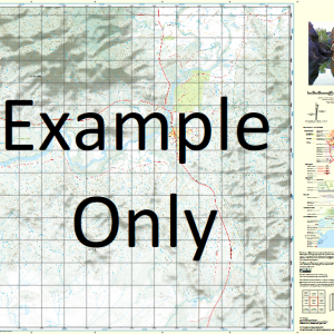
This Topographic Map is produced by Geoscience Australia; Australia s national geospatial organisation.
GA topographic maps (many of which are produced in partnership with the Army) are generally older than those maps produced by the State Governments over the same area. This makes GA maps particularly useful for identifying historic features, such as old mines and diggings.
Geoscience Australia maps generally considered to be more pleasing in design and compilation then the more modern State Government productions.
At this scale, 1cm on this map represents 1km on the ground. A standard map (which is square) covers an area of approximately 54km by 54km, with a contour interval of 20m. This map contains natural and constructed features including road and rail infrastructure, vegetation, hydrography, contours, localities and some administrative boundaries.
Please note the date of the map, as this will impact the currency of information, particularly regarding infrastructure, roads, etc.
Dalkeith Erindale Boronga Orange Grove Bunurong Bynong Bonnie Doon Wombi Greenslopes The Pinnacles Alva Loree Silverlea St Quentin Dunrobin Pine Park Willow Vale Belle Brae Glen Burn Riverview Nug Nug Ranch The Gums Mountain View Branchal Rose Valley Balvenie Sugarloaf Mount Typo Catherine Bright Myrtleford Porepunkah Andersons Peak Gentle Annie Creek Ant Hill Saddle Apex Lookout Australasia Tunnel Mine Australian Forest Industries Mills Austrian Creek Back Creek Back Wall Bakers Gully Bakers Gully Creek Bald Hill Bald Hill Creek Bald Hill Spur Ballroom Walking Track Barkers Gully Creek Barwidgee Myrtle Creek Barwidgee Creek Public Recreation Reserve Basin Creek Bell Gully Bells Gully Ben Lund Gully Bents Lookout Cannon Hill Billsons Lookout Biscuit and Cheese Black Mare Creek Black Range Running Creek Blackfellows Peak Blackfellows Plain Bogong Plain Boulder Creek Boulder Creek North Branch Boulder Creek South Branch Boulder Knob Boynton Winery Braithwaite Plantation Brandy Gully Brandy Creek Bread and Butter Creek May Day Creek Gap Bright Fire Station Bright Group Plantations Bright Magistrates Court Bright Municipal Caravan Park Bright P-12 College Bright Police Station Bright Post Office Bright Recreation Ground Bright Shire Office Buckeye Creek Buckland Buckland Bridge Buckland River Buckland River Left Branch Scotchmans Creek Buffalo Creek Buffalo Gap Buffalo Plateau Buffalo River Buffalo River Fire Station Buffalo Sugarloaf Bungamero Bunyip Creek Camp Creek Camp Plain Carboor Carboor Fire Station Carboor Upper Primary School Carboor Upper Telephone Exchange Carbour Public Hall Carleys Gully Carliles Lookout Carmichael Point Caseys Creek Centenary Park Chalwell Galleries Chapel Creek Chinamans Creek Clapp Lookout Clarrie Ardern Reserve Clear Creek Clear Creek North Branch Clear Creek South Branch Clear Spot Fire Tower Clear Spot Walking Track Clearspot Lookout Clem Creek Coghill Creek Connelly Gully Connellys Gully Cool Creek Coolumbooka Corr Creek Corral Peak Couch Creek Craigs Creek Cresta Ski Run Croft Gully Croppers Creek Cropper Creek Hilton Croppers Gap Crouchers Gully Crystal Brook Curtis Mine Dandongadale Dondangadale River Dederang Deep Creek Dels Plain Devils Couch Devils Creek Devils Creek Bridge Devils Creek Left Branch Devils Creek Right Branch Devils Creek West Branch Dikson Falls Dingo Creek Dingo Dell Dingo Ridge Dougherty Bridge Drillhole Rocks Dunphys Creek Mount Clear Spot Eagle Point Echo Point Edinboro Castle Edinboro Creek Egg Rock Ella Creek Elsies Peak Emu Creek Eurandelong Eurobin Eurobin Creek Eurobin Falls Eurobin Gap Eurobin Point Eurobin Post Office Fairley Creek Falls Lookout Faulkner Gully Faulkner Reserve Fire Ravine Firefighters Creek Five Acre Plain Four Mile Creek Gap Creek Gapsted Gapsted Fire Station Gapsted Public Hall Garden Gully Gentle Annie Gap Giants Causeway Gladstone Mine Goldies Spur Green Hill Grenville Gully Growlers Creek Gulf Creek Gun Flat Creek Hall Gully Happy Valley Public Hall Harris Lane Bridge Highmeadows Plain Home Mine Home To Dinner Mine Hoopers Crossing Bridge Horns Lookout Horseshoe Creek Hospice Plain House Creek Howells Falls Huggins Lookout Mount Emu Creek Ivan Swinburne Reserve Jagoe Creek Jessies Lookout Joe Sear Gully Junction Plantation Kancoona Gap Kangaroo Creek Keanes Creek Keasts Lookout Keatings Creek Kennedys Creek Kirks Bridge Kissing Stones Klondyke Creek Kowan Plain Ladies Bath Falls Lady Carmichael Falls Lake Buffalo Lake Catani Lake View Lake Walk Lamber Creek Le Souef Peak Lewis Creek Lickhole Gully Lily Creek Lily Creek Saddle Little Buffalo Creek Little Dandongadale Creek Long Corner Creek Long Gully Long Hand Mine Long Jack Creek Long Plain Long Tunnel Mine Lookout Hill Lower Bunyip Plain Luke Gully Lyrebird Hill Lyrebird Peak Lyrebird Plain Mac Creek Mackeys Lookout Macs Creek Macs Point Maguire Gully Maharatta Mahomets Coffin Manfields Lookout Marney Creek Marriotts Lookout Martins Bridge Masterton Hill Matong Matong North Mayday Creek McGuffies Bridge McIvor Spur McPhee Gully Merriang Plantation Mills Bridge Mollison Plain Mollisons Galleries Moore Hill Morgans Creek Morning Star Mine Morockdong Morses Creek Morses Creek Plantation Morses Creek West Branch Mount Angus The Chalet Mount Buffalo National Park Mount Buggery Mount Dunn Mount Emu Mount Mary Mount McIver Mount McLeod Mount McLeod Creek Mount Porepunkah Mount Warwick Mud Hole Gully Mudhole Gully Murrays Creek Mushroom Rock Mussel Rock Myrtleford Fire Station Myrtleford Magistrates Court Myrtleford Memorial Hospital Myrtleford Police Station Myrtleford Post Office Myrtleford Primary School Myrtleford Secondary College Myrtleford Showgrounds Mystery Basin Na Boc Leis Creek Nelson Creek New Chum Gully Newths Bridge Newton Creek Nil Gully Nil Gully Reservoir Nimmo Bridge Nine Mile Spur Nolans Creek North Buffalo Plateau North Buffalo Saddle Nug Nug Falls Nug Nug Hills Nug Nug Reserve Nug Nug Telephone Exchange Nug Nug Wa Creek Og Gog Magog Old Galleries One Mile Creek One Mile Creek Plantation Opossum Ridge Osbornes Bridge Ovens Ovens Plantation Paddy Hill Panbulla Park Plantation Parrot Peak Pheasant Creek Pioneer Gold Mine Pioneer Park Recreation Reserve Porepunkah Fire Station Porepunkah Gully Porepunkah Gully Creek Porepunkah Plantation Porepunkah Post Office Porepunkah Primary School Porepunkah Public Hall Porepunkah Recreation Reserve Possum Point Pulpit Rock Queen Victoria Pinnicle Quins Gap R C McNamara Reserve Racecourse Plantation Red Jacket Gully Red Jacket Spur Reeds Lookout Reedy Creek Reform Hill Trig Research Tunnel Mine Roberts Creek Roberts Creek Bridge Rocky Creek Rocky Creek Falls Rocky Point Creek Rollasons Falls Ron Nicoll Bridge Rose River Rosewhite Rosewood Fire Station Running Creek Plantation Running Jump Creek Sanderson Creek Sandstone Spur Sandy Creek Sandy Creek North Branch Sandy Creek South Branch Sandy Creek Spur Sardine Creek Scotchman Creek Scrubby Creek Second Plain Shallow Creek Shippen Gully Signal Peak Skeleton Gully Slaughteryard Creek Smiths Camp Smoko Creek Snake Ridge South Buffalo Creek South Buffalo View Point South Face Split Peak Split Rock Split Rocks Stackeys Gully Stakers Lookout Stanley Rocks Star Bridge Station Creek Stephens Bridge Stonehenge Stony Creek Stony Gully Stringybark Creek Sugarloaf Hill Tatra Inn Tawanga Taylor Gully Taylors Bridge The Basin The Big Walk The Bridge of Sighs The Castle The Cathedral The Corral The Costitution The Egg Rock The Font The Gap The Giants Playground The Gorge The Haunted Gorge The Hill of Rock The Horn The Thumb The Landslide The Leviathan The Long Plain The Monolith The North Bluff The Pebble The Riven Rock The Rocks Saddle The Sarcophagus The Sentinel The South Bluff The Tombstones The Underground River The Valley of The Gods The Washout The Whale Rock The Woolpack Three Knights Three Rock Peak Tipflat Creek Towamba Tower Hill Trig Hill Trig Hill Trig Twin Falls Twin Falls Gorge Two Mile Creek Two Mile Creek Plantation Ulrich Hill Ulrich Peak Valley View Walking Track Victoria Bridge Victoria Gully View Point View Point Nature Walk Wall of China Wallaby Hill Wandiligong Wandiligong Creek Wandiligong Post Office Wandiligong Primary School Wandiligong Public Hall Water Reserve Plantation Whiskey Creek White Hill White Star Gully White Star Mine Whorouly Whorouly Creek Whorouly East Primary School Whorouly Fire Station Whorouly Post Office Whorouly Primary School Whorouly Public Hall Whorouly South Primary School Whorouly South Public Hall Whorouly Telephone Exchange Wild Dog Creek Wild Dog Plain Wild Horse Gap Wilfred Hill Wilkinsons Lookout Williams United Mine Winteriga Wirbill Plain Woodcutters Walking Track Woolshed Creek Work Gully Wright Creek Yarrarabula Creek Yarrarabula Creek Central Branch Yarrarabula Creek North Branch Yarrarabula Creek South Branch Bobinawarrah Gapstead Whorouly South Barwidgee Creek Ovens Vale Kancoona Happy Valley Creek Happy Valley Nug Nug Carboor Upper Anderson Peak Mount Buffalo Chalet Yarrarabulla Creek Brookside German Creek Eagle Peak The Hump Mount Buffalo Buffalo Peak Dondangadale Buckland Lower Lower Buckland Dandongadale River Upper Buckland Catherine River
| Title | Paper, Laminated |
|---|
Related products
-
QLD 6647 Sale
$12.50 -
QLD 6558 Fashion
$12.50 -
QLD 6550 Supply
$12.50 -
QLD 6557 Online Sale
$12.50 -
QLD 6546 Discount
$12.50