GA 7947 – Listowel Downs For Cheap
- Estimated Delivery : Up to 4 business days
- Free Shipping & Returns : On all orders over $200
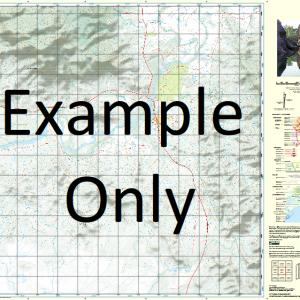
This Topographic Map is produced by Geoscience Australia; Australia s national geospatial organisation.
GA topographic maps (many of which are produced in partnership with the Army) are generally older than those maps produced by the State Governments over the same area. This makes GA maps particularly useful for identifying historic features, such as old mines and diggings.
Geoscience Australia maps generally considered to be more pleasing in design and compilation then the more modern State Government productions.
At this scale, 1cm on this map represents 1km on the ground. A standard map (which is square) covers an area of approximately 54km by 54km, with a contour interval of 20m. This map contains natural and constructed features including road and rail infrastructure, vegetation, hydrography, contours, localities and some administrative boundaries.
Please note the date of the map, as this will impact the currency of information, particularly regarding infrastructure, roads, etc.
Gowan Brides Creek Cootabynia Alva Listowel Downs Lynbrydon Caranna Amaroo Aubeg Aubeg Creek Back Creek Blackbutt Tank Blackwood Creek Blanc Bobs Gully Boggy Creek Box Creek Bull Gully Cave Hill Chamouni Mount Conebreak Cook Creek Coolibah Creek Cootabynia Water Facility Cory Peak Edinburgh Edinburgh Range Mount Edinburgh Ennismore Flat Top Half Moon Dam Joey Peak Listowel Listowel Valley Lorne Lorne Mountain Mosquito Creek One Stone Hill Overshot Dam Pleasant Creek Stonehenge Bore Stonehenge Creek The Cone Thistle Thistle Creek Tomahawk Creek Wallaroo Range McLeod Creek Bonnie Doon Bore Brides Creek Bore Tomahawk Tank Doon Creek Blacks Creek Bore Vickery Bore Brokendale Bore Cootabynia Bore Lyalls Inlet Aubeg Tank High Range Strathspey Bore Mountain Paddock Bore Cave Hill Bore Bull Creek Wellclose Tank
| Title | Paper, Laminated |
|---|
Related products
-
QLD 6560 For Cheap
$12.50 -
QLD 6546 Discount
$12.50 -
QLD 6549 Hot on Sale
$12.50 -
QLD 6554 Discount
$12.50 -
QLD 6563 For Cheap
$12.50