GA 7755 – Cameron Downs Online
- Estimated Delivery : Up to 4 business days
- Free Shipping & Returns : On all orders over $200
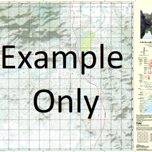
This Topographic Map is produced by Geoscience Australia; Australia s national geospatial organisation.
GA topographic maps (many of which are produced in partnership with the Army) are generally older than those maps produced by the State Governments over the same area. This makes GA maps particularly useful for identifying historic features, such as old mines and diggings.
Geoscience Australia maps generally considered to be more pleasing in design and compilation then the more modern State Government productions.
At this scale, 1cm on this map represents 1km on the ground. A standard map (which is square) covers an area of approximately 54km by 54km, with a contour interval of 20m. This map contains natural and constructed features including road and rail infrastructure, vegetation, hydrography, contours, localities and some administrative boundaries.
Please note the date of the map, as this will impact the currency of information, particularly regarding infrastructure, roads, etc.
Ensay Kentle Downs Sutton Downs Afton Downs Redcliff Hillview Arrara Peronne Zara Strathroy Braemar Barragunda Yantebobbera Cameron Downs Alba Arra Aynsley Beddoe Braemar Water Facility Cameron Mount Christison Crooked Creek Fairview Hill Harriet Mount Harriet Horse Creek Horse Shoe Bend Creek Horse Shoe Bend Water Facility Ingleounda Creek Lea Creek Mount Margaret Merse Creek Mingeburra Mountain Creek Mount Pollux Rocky Creek Roland Station Creek Stone Creek Tent Creek Warianna Watten Watten Water Facility One Mile Bore Boundary Tank Watten Station Watten Eight Mile Bore Four Mile Bore Watten Bore Nine Mile Bore Scour Bore Alba Station Alba Siding Sandys Tank Reay Bore Tableland Bore Stoney Creek Bore Mountain Bore Wick Bore Emu Creek Bore Horse Shoe Bend Bore Bridle Creek Bore Wick Mill Bore Ingleounda Bore Boree Ridges Braemar Bore Yantabobbera Bore Monavale Bore West Branch Ingleounda Creek Ingleounda Tank Landsborough Tank Broken Dam Bore Theresa Downs Bore Glenanar Bore Minneburra Bore Theresa Creek
| Title | Paper, Laminated |
|---|
Related products
-
QLD 6562 Sale
$12.50 -
QLD 6548 For Cheap
$12.50 -
QLD 6557 Online Sale
$12.50 -
QLD 6563 For Cheap
$12.50 -
QLD 6559 Discount
$12.50