GA 1929-3 – Leeuwin Discount
- Estimated Delivery : Up to 4 business days
- Free Shipping & Returns : On all orders over $200
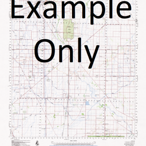
This Topographic Map is produced by Geoscience Australia; Australia s national geospatial organisation.
GA topographic maps (many of which are produced in partnership with the Army) are generally older than those maps produced by the State Governments over the same area. This makes GA maps particularly useful for identifying historic features, such as old mines and diggings.
Geoscience Australia maps generally considered to be more pleasing in design and compilation then the more modern State Government productions.
At this scale, 2cm on this map represents 1km on the ground. A standard map (which is square) covers an area of approximately about 25km by 25km, with a contour interval of 10m. This map contains natural and constructed features including road and rail infrastructure, vegetation, hydrography, contours, localities and some administrative boundaries.
Please note the date of the map, as this will impact the currency of information, particularly regarding infrastructure, roads, etc.
Augusta Augusta Hillview Golf Club Augusta Primary School Augusta River Mouth Barrack Point Black Stump Blackwood River Brennan Reef Cape Hamelin Cape Leeuwin Cape Leeuwin Lighthouse Charandor Civic Park Cole Rock Cosy Corner Cumberland Rock Dead Finish Anchorage Deepdene Deepdene Cave Deere Reef Dick Island Duke Head East Augusta Easter Cave Flinders Bay Flinders Island Georgiana Park Glenleigh Granny Pool Green Hill Groper Bay Hardy Inlet Hillier Park Honeycomb Rocks Hukochini Island Point Jack Ledge Jewel Cave Knobby Head Kudardup Labyrinth Cave Ledge Point Leeuwin Lion Islands Lions Park Long Swamp Masterman Cove Matthew Flinders Memorial Matthew Flinders Park Maureens Farm Minns Ledge Molloy Channel Molloy Island Molloy Memorial Moondyne Cave Murrumbong North Bay Pioneer Memorial Point Dalton Point Ellis Point Frederick Point Irwin Point Matthew Point Pedder Point Trafalgar Quarry Bay Redman Brook Ringbolt Bay Rockville Sam Griffiths Park Sarge Bay Scotsman Rock Scott National Park Scott River Seal Island Seine Bay Shervington Park Skippy Rock South East Rocks South West Breaker Spout Rock Square Rock St Alouarn Island St Alouarn Island Nature Reserve St Alouarn Islands Storm Bay Swan Lakes Tallagandra The Copse The Deadwater The Landing The Landing Place The Long Blackboy The Old Cave The Spring The Whaling Thomas Island Torr Shamba Turner Brook Turner Brook Farm Turner Park Turnwood Creek Wahroonga West Bay West Bay Creek West Bay Stud Wirralee South West Rock Swan Lake Geographe Reef Jacks Ledge Saint Alouarn Island Saint Alouarn Islet Saint Alouarn Islands
Related products
-
QLD 6552 on Sale
$12.50 -
QLD 6646 Sale
$12.50 -
QLD 6561 Online Sale
$12.50