GA 8027 – Jerilderie Online
- Estimated Delivery : Up to 4 business days
- Free Shipping & Returns : On all orders over $200
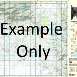
This Topographic Map is produced by Geoscience Australia; Australia s national geospatial organisation.
GA topographic maps (many of which are produced in partnership with the Army) are generally older than those maps produced by the State Governments over the same area. This makes GA maps particularly useful for identifying historic features, such as old mines and diggings.
Geoscience Australia maps generally considered to be more pleasing in design and compilation then the more modern State Government productions.
At this scale, 1cm on this map represents 1km on the ground. A standard map (which is square) covers an area of approximately 54km by 54km, with a contour interval of 20m. This map contains natural and constructed features including road and rail infrastructure, vegetation, hydrography, contours, localities and some administrative boundaries.
Please note the date of the map, as this will impact the currency of information, particularly regarding infrastructure, roads, etc.
Jerilderie Algudgerie Weir Berrigan Creek Escape Blind Creek Bolton Booroobanilly Broome Cadell Carnerney Cocketgedong Coree North Coree South Delta Creek Delta Dam Elliott Park Four Corners Lagoon Goolgumbla Hardie Hoggarths Sandhills Lake Jerilderie Jerilderie North Jerilderie South Carneeney Dam Eastern Park 4 Corners Lagoon Logie Brae Mabins Corner Tank Mabins Corner Well Mccoys Sandhill Mairjimmy Lagoon Mairjimmy Railway Station Mairjimmy-State Forest Monash Park Nardoo Nine Mile Dam North Yathong Railway Station Stanley Thurrowa Turn Back Jimmy Creek Wangamong Western Park White Waterhole White Water Hole Wilson Wood Woperana State Forest Wunnamurra Wunnamurra Lagoon Wunnamurra Railway Station Yathong South Yellow Creek Bundure Bundure North Burchetts Lagoon Mairjimmy Billabong Creek Jerilderie Reservoir Yathong Jerilderie Nature Reserve Katamatite Telephone Exchange Riverina Hawks Nest Boyd Tank East Park Four Mile Dam Bundure Tank Wood Park Bendigo Dam North Yathong Colombo Creek Turn Back Jimmy Tank Cocketgedong Creek Ardgour Carnarney Dam Nowranie Creek Nowrania Creek Coree Carrabunganung Well Algudgery Creek Four Corner Lagoon Box Creek South Wunnamurra South Yathong Boongara Algudgerie Creek Coreen Creek Nowranie Tank Bentwood Berrigan Well Wannamurra Well
| Title | Paper, Laminated |
|---|
Related products
-
QLD 6559 Discount
$12.50 -
QLD 6551 Supply
$12.50 -
QLD 6549 Hot on Sale
$12.50