GA 7861 – St Ronans Sale
- Estimated Delivery : Up to 4 business days
- Free Shipping & Returns : On all orders over $200
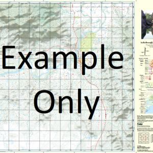
This Topographic Map is produced by Geoscience Australia; Australia s national geospatial organisation.
GA topographic maps (many of which are produced in partnership with the Army) are generally older than those maps produced by the State Governments over the same area. This makes GA maps particularly useful for identifying historic features, such as old mines and diggings.
Geoscience Australia maps generally considered to be more pleasing in design and compilation then the more modern State Government productions.
At this scale, 1cm on this map represents 1km on the ground. A standard map (which is square) covers an area of approximately 54km by 54km, with a contour interval of 20m. This map contains natural and constructed features including road and rail infrastructure, vegetation, hydrography, contours, localities and some administrative boundaries.
Please note the date of the map, as this will impact the currency of information, particularly regarding infrastructure, roads, etc.
St Ronans Lava Plains Barkers Knob Barwon Creek Billgolla Blackfellow Hill Bob Swamp Boomerang Cleanskin Creek Commissioners Cap Craigie Burn Craigs Pocket Dingo Creek Dirty Wash Creek Durbin Creek Edmonds Scrub Ellenborough Emu Hill Mount Firth Forty Mile Scrub National Park Granite Range Kalkani Cone Kellys Creek Kinrara Crater Mount Lamb Mount Lang Lava Waterholes Lost Pinnacle Mount Lynn Macks Range Mount Margaret Marys Hope Creek Match Box Creek Mount McBride Mount McMaster Meadowbank Messmate Creek Middle Hill Middle Mountain Minnemore Mount Mist Mulindie Mount Munana Murronga Crater Nannys Waterhole O Briens Waterhole One Hundred Mile Swamp Pine Creek Mount Poole Pretty Plains Creek Rangaranga Hill Mount Rosey Rotherfield Well Rudds Pinnacle Mount Shuteye Silent Hill Swamp Lagoon Mount Tabletop Ten Mile Creek The Granite Knobs The Pinnacles The White Waterhole Towry Umbrella Spring Undara Crater Westhall Windmill Hill Yaramulla Yedtheron Mount Rosey Resources Reserve Undara Volcanic National Park Kinrara National Park Mount Surprise Saint Ronans Bakers Knob Racecourse Knob Mount Laing Table Table Mountain Mount Lang Homestead
| Title | Paper, Laminated |
|---|
Related products
-
QLD 6563 For Cheap
$12.50 -
QLD 6559 Discount
$12.50 -
QLD 6554 Discount
$12.50 -
QLD 6553 For Discount
$12.50 -
QLD 6551 Supply
$12.50